Kailua-Kona Sunset, Alii Drive
The Big Island has earned its name due to the fact that it is larger than the land area of all the other Hawaiian Islands put together. If you are familiar with some of the other Hawaiian Islands such as Oahu, the Big Island will be a stark contrast with few crowds, little traffic, and beaches and beautiful scenery scattered across both sides of the island for many many miles.
Most people consider the Big Island as “old Hawaii”, with sleepy towns dating back decades and most parts of the island are unspoiled and underdeveloped. The large hotels and mega resorts are isolated to one portion of the island and the natural beauty of Hawaii has been preserved.
The beaches, mountains, and sights are all spread out throughout the island - affording you more room to explore and less crowds to compete with. Youngest of the Hawaiian Islands, the Big Island is expanding each day as the Kilauea volcano continues erupting. Below, we describe the different regions of the Big Island, starting at the northern tip and going counter-clockwise.
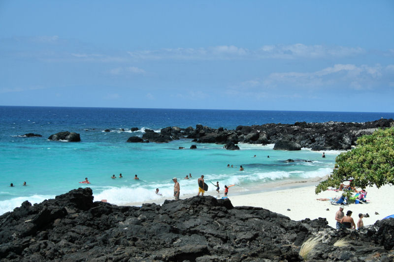 Kua Bay Beach, Kohala Coast |
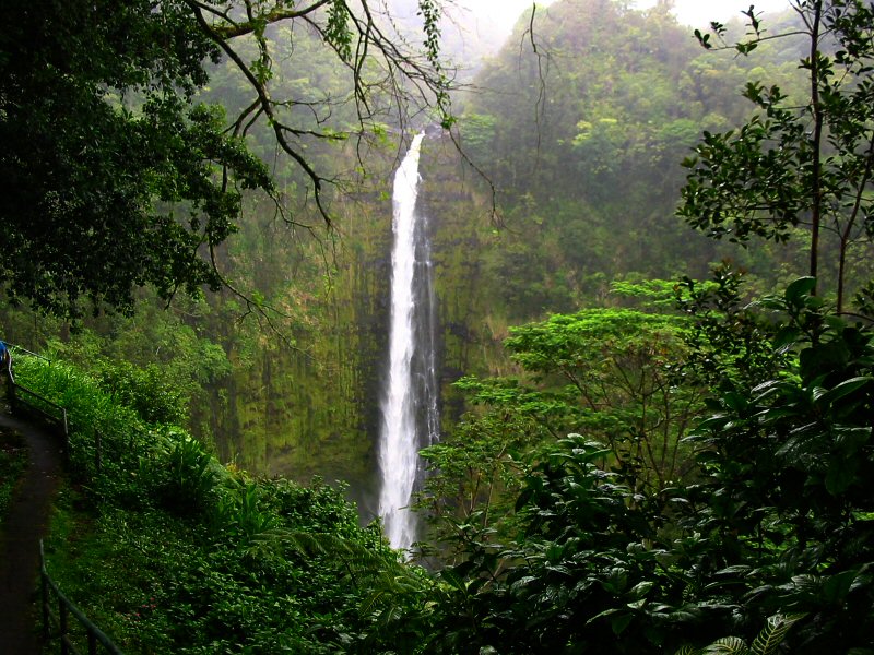 Akaka Falls, Hamakua Coast |
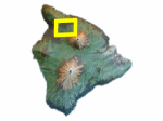
North Kohala
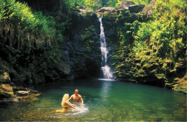
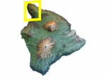 This region is at the northern tip of the Big Island where sleepy small towns and the countryside of yesteryear remain unchanged. Here you will find rugged terrain with the Kohala Mountain to the east, the beautiful Pacific Ocean on the west, and grassy meadows and lush vegetation in between. As you travel along Highway 270, on a clear day you can see the Haleakala volcano on the island of Maui across the water. You will pass the rustic town of Hawi and the road will finally come to an end at the picturesque Pololu Valley Lookout. From the lookout, you can see wave after wave crashing onto the black sand beach hore below. The coast here is rugged, covered in dense vegetation and dotted with waterfalls and rivers.
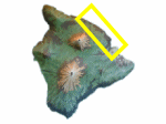
Kohala Coast
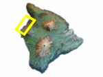 Dominated by bright sunny skies and warm waters, the Kohala Coast is where the mega-resorts of the Big Island reside. Known for spectacular weather for sunbathers and beach-goers, the Kohala Coast has some of the prettiest beaches on the island. The climate here is sunny, hot and dry, with nearly zero rainfall. The landscape is dominated by fields of dried lava adorned with white rock graffiti. The Kohala Coast stretches from the Kona Keahole Airport to the harbor at Kawaihae. The coast varies from secluded gems like Makalawena Beach to the ever-popular Hapuna Beach State Park. The snorkeling on the Kohala Coast is decent, but visibility can be low at times due to the sandy bottom of nearby sandy beaches. Read more about the Kohala Coast.
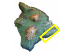
North Kona
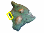 This is the busiest and most widely-known part of the Big Island. The
touristy seaside village of Kailua-Kona is located here, at the edge of shallow-water Kailua Bay. This bustling town offers wonderful dining, shopping, and tour opportunities along with many historic attractions - but still gives visitors a small-town feeling. The beaches here are not as vast as they are on the Kohala Coast, but beaches such as Kahaluu do offer exceptional snorkeling. Just east of town are the slopes of the Hualalai Volcano and there are several scenic drives that provide impressive views of the coast as you wind your way up to the higher elevations. Read more about the town of Kailua-Kona.
South Kona
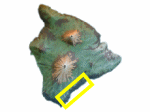
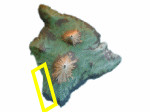 This is the most historically significant region on the Big Island. Excellent snorkeling and diving can also be found in South Kona. Water clarity is optimal with visibility exceeding 80 feet! South of Kailua, on the slopes of the volcano is the charming artisan town of Holualoa (see map). Continuing south, you will pass through the small town of Honalo (see map), with its many kayak rental stores. The Kealakekua Bay marine preserve is located in South Kona, where Captain Cook was killed in 1779. Nearby is Pu ‘uhonua O Honaunau (Place of Refuge) National Park - a well preserved ancient Hawaiian village, and the famous Painted Church. South Kona is also known as coffee country. The southern slopes of Hualalai Volcano provides the perfect climate to grow world-famous Kona coffee. The road gains elevation as you drive south and you get a greater sense of the fertility here. Continuing on Route11, you will round the southern slope of Mauna Loa and pass South Point (see map) as you traverse to the eastern side of the island.
Volcano
 This southern-most region is also known as the Ka’u district. Continuing on Route 11 to the eastern side of the island, you will come across the towns of Naalehu, Honuapo and eventuall to Pahala. Nearby on the coast Punaluu Black Sand Beach. Punaluu is one of the most famous black sand beaches in Hawaii and a frequent nesting site for Hawaiian Green Sea Turtles. Continuing north on highway 11 you will come to the Volcanoes National Park. Your drive continues with the shield volcano Mauna Loa on your left and the dried lava flows of the Kilauea Volcano on your right. Highway 11 turns inland here with the national park off to the east. The road gains altitude as it passes the park entrance and continues north towards the town of Hilo.
Temperature at the volcano varies by elevation. Weather at Kilauea’s summit (4000′ elevation) varies daily and may be rainy and chilly any time of the year. At the summit of the volcano, temperatures may be 12 to 15 degrees cooler than at sea level. The coastal plain at the end of Chain of Craters Road, where lava flows into the ocean, is often hot, dry, and windy with the possibility
of passing showers. Read more about the Kilauea Volcano.
Puna
 The Puna district stretches from the Volcanoes National Park north to Hilo town. This area is underdeveloped with spread out settlements with a very rural look. Small settlements such as Mountain View, Kurtistown, Pahoa, and Keau dot the landscape. This tropical climate on this eastern-most point of the wind-ward side of the island receives a lot of rain and the vegetation is lush green. The coast of Puna is rugged, its south facing shore pounded by waves. One attraction worth visiting here is the Kapoho Tide Pools where the protected waters are always calm and great for snorkeling. Other attractions nearby are the Lava Tree State Park and Isaac Hale Beach Park at Pohoiki Bay. Check out the 5-hour guided tour, “Best of Puna”.
Hamakua Coast
 The fertile and beautiful Hamakua Coast stretches north of the town of Hilo, all the way to the Waipio Valley. Dramatic sea cliffs, lush tropical vegetation, rainbows, and steep gorges shaped by rivers and waterfalls dominate this 50 mile stretch of coast along the eastern side of the Big Island. The thriving green rain forest here is fed by more than 140 inches of rain per year. The steep terrain is defined by the downward slopes of the Mauna Kea volcano punctuated by sheer cliffs at the coast. The road here snakes its way through dramatic water-carved gulches and valleys thick with tropical foliage. There are many scenic attractions along the Hamakua Coast including Akaka Falls, Onomea Bay, and the Waipio Valley Overlook. Read more about the Hamakua Coast. Check out the 4-hour guided tour of Hawaii waterfalls and the Hamakua Coast.
Waimea (Kamuela)
 At the town of Honokaa, your journey takes you inland and uphill. The Mauna Kea Volcano is in front of you as you begin to feel the cool mountain air and see the grassy meadows around you. You are approaching the town of Waimea (also known as Kamuela) in the heart of the island. Herds of cattle are grazing in the rolling pastures - this is cowboy country! The altitude up here reaches 4,000 feet of elevation and the climate can be cool and damp, even in the summer time. Continuing west will take you on a descending, winding road back down to the western coast of the island at the Kawaihae Harbor, Kohala. You have just completed our around-the-island tour. Read more about the town of Waimea.
Read our next article: Sample Travel Itineraries
Travel Planning Articles
Where to Stay - Three different parts of the island to stay - which is best?
Vacation Rentals - Big Island Vacation rentals are a deal
Bargain or 5 Star Hotel - Stay at a resort or a bargain hotel
Discount Big Island Hotels - Check out the latest rates
Travel Planning Articles
Planning your Trip - When to come, how long to stay, books
Vacations for Families - Best family beaches, activities for youngsters, infants, teens
Hawaiian Cruise Passengers - Information about port calls in Hawaii
Sample Travel Itineraries - Suggested itineraries, 1-2 day, 1 week
Island Activities Guide - Guide to the activities & tours
Regions of the Big Island - Geography and climate descriptions
Big Island Transportation - How to get there, plan your driving
Packing for your Trip - Big Island scenery & weather is diverse
Big Island Wedding Planner - How to plan your wedding in Hawaii
Shopping in Hawaii
Big Island Shopping Guide - Guide to the shopping destinations
Hawaii Souvenirs - The best souvenirs to buy in Hawaii
Gear & Equipment Articles
Gear for your Trip - Get outfitted with the right gear
GPS Points of Interest (POI) - GPS Coordinates for Points of Interest